Weather Alerts for California
1. Air Quality Alert for: Imperial County Southwest; Chuckwalla Mountains; Imperial County Southeast; Imperial County West; Imperial Valley; Palo Verde Valley
2. Freeze Warning for: Interior Del Norte; Northeastern Interior Humboldt; Southeastern Interior Humboldt; Southern Trinity; Northwestern Interior Mendocino; Northeastern Interior Mendocino; Northern Lake; Northwestern and Central Trinity; Northeastern Trinity; Western Lake
3. Freeze Warning for: Lassen-Eastern Plumas-Eastern Sierra Counties
4. Freeze Warning for: Surprise Valley California; Northern Washoe County
5. Freeze Warning for: Western Siskiyou County; Eastern Curry County and Josephine County; Jackson County
6. Frost Advisory for: Coastal Del Norte; Northern Coastal Humboldt; Southwestern Humboldt; Coastal Mendocino; Southwestern Interior Mendocino; Southeastern Interior Mendocino
7. Lake Wind Advisory for: Kern River Valley
8. Wind Advisory for: Apple and Lucerne Valleys
9. Wind Advisory for: Indian Wells Valley; Mojave Desert
10. Wind Advisory for: Mojave Desert Slopes
11. Wind Advisory for: San Bernardino and Riverside County Valleys-The Inland Empire; San Bernardino County Mountains; Santa Ana Mountains and Foothills; Orange County Inland
12. Wind Advisory for: San Luis Obispo County Beaches; Santa Barbara County Central Coast Beaches
13. Wind Advisory for: Santa Barbara County Interior Mountains; Southern Ventura County Mountains; Northern Ventura County Mountains; Interstate 5 Corridor
14. Wind Advisory for: Santa Barbara County Southwestern Coast; Santa Ynez Mountains Western Range; Santa Ynez Mountains Eastern Range
15. Wind Advisory for: Santa Clarita Valley; Ventura County Beaches; Ventura County Inland Coast; Central Ventura County Valleys; Western Santa Monica Mountains Recreational Area; Calabasas and Agoura Hills; Western San Fernando Valley; Southeastern Ventura County Valleys; Santa Susana Mountains
16. Wind Advisory for: Santa Lucia Mountains
17. Wind Advisory for: South-Central Shasta County Including Redding Metro; Northern Sacramento Valley in Tehama County; Central Glenn County Including Interstate 5; Eastern Glenn County; Butte County Below 1000 ft; Central Colusa County Including Interstate 5; Eastern Colusa County; Sutter and Yuba Counties Below 1000 ft; Capay Hills of Yolo County and Vaca Hills of Solano County; Western Yolo County Including Capay Valley and Interstate 505; Central Yolo and Northeast Solano Counties Including Woodland and Davis; Sacramento Metro and Western El Dorado and Amador Counties; Central Solano County Including Fairfield and Vacaville; Southwestern Solano County Including Vallejo; Sacramento County Delta; San Joaquin County Delta
18. Wind Advisory for: Western San Gabriel Mountains and Highway 14 Corridor; Eastern San Gabriel Mountains
Want more detail? Get the Complete 7 Day and Night Detailed Forecast!
Current U.S. National Radar--Current
The Current National Weather Radar is shown below with a UTC Time (subtract 5 hours from UTC to get Eastern Time).

National Weather Forecast--Current
The Current National Weather Forecast and National Weather Map are shown below.

National Weather Forecast for Tomorrow
Tomorrow National Weather Forecast and Tomorrow National Weather Map are show below.

North America Water Vapor (Moisture)
This map shows recent moisture content over North America. Bright and colored areas show high moisture (ie, clouds); brown indicates very little moisture present; black indicates no moisture.

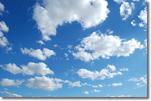
Weather Topic: What are Cumulonimbus Clouds?
Home - Education - Cloud Types - Cumulonimbus Clouds
 Next Topic: Cumulus Clouds
The final form taken by a growing cumulus cloud is the
cumulonimbus cloud, which is very tall and dense.
The tower of a cumulonimbus cloud can soar 23 km into the atmosphere, although
most commonly they stop growing at an altitude of 6 km.
Even small cumulonimbus clouds appear very large in comparison to other cloud types.
They can signal the approach of stormy weather, such as thunderstorms or blizzards.
Next Topic: Cumulus Clouds
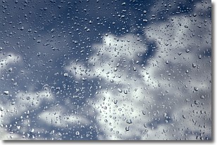
Weather Topic: What is Drizzle?
Home - Education - Precipitation - Drizzle
 Next Topic: Evaporation
Drizzle is precipitation in the form of water droplets which are
smaller than raindrops.
Drizzle is characterized by fine, gently falling droplets and typically does not
impact human habitation in a negative way. The exception to this is freezing drizzle,
a condition where drizzle freezes immediately upon reaching earth's surface.
Freezing drizzle is still less dangerous than freezing rain, but can
potentially result in hazardous road conditions.
Next Topic: Evaporation
Current conditions powered by WeatherAPI.com


