Weather Alert in Florida
Flood Warning issued September 2 at 8:57AM EDT until September 7 at 8:00AM EDT by NWS Melbourne FL
AREAS AFFECTED: Lake, FL; Volusia, FL
DESCRIPTION: ...The Flood Warning is extended for the following rivers in Florida... St Johns River Near Astor affecting Lake and Volusia Counties. .On the Saint Johns River at Astor, northerly winds and recent rainfall over the basin are maintaining a slow climb through Minor Flood Stage. The river is forecast to slowly fall late in the week or this weekend to near 2.3 feet. However, additional rainfall or lingering northerly winds could slow the rate of decline. For the St. Johns River...including Astor...Minor flooding is forecast. Additional information is available at www.weather.gov. The next statement will be issued Wednesday afternoon at noon EDT. * WHAT...Minor flooding is occurring and minor flooding is forecast. * WHERE...St Johns River near Astor. * WHEN...Until Sunday morning. * IMPACTS...At 2.8 feet, Docks and boat ramps covered at South Moon Fish Camp and approaching sea wall at Blair's Jungle Den. Water approaching sites closest to the river at Fish Tales RV Resort and Astor Landing Campground. Portion of Clair Street covered by river water south of the Butler Boat Ramp. Docks underwater at the Astor Bridge Marina and along Riveredge Drive. Portions of Fox Road are covered with water nearest to the river. Acorn, Hazelnut and Redbud roads are underwater with yards inundated. * ADDITIONAL DETAILS... - At 8:30 AM EDT Tuesday the stage was 2.6 feet. - Bankfull stage is 2.0 feet. - Recent Activity...The maximum river stage in the 24 hours ending at 8:30 AM EDT Tuesday was 2.6 feet. - Forecast...The river is expected to rise to a crest of 2.8 feet by tomorrow morning. - Flood stage is 2.3 feet. - http://www.weather.gov/safety/flood
INSTRUCTION: N/A
Want more detail? Get the Complete 7 Day and Night Detailed Forecast!
Current U.S. National Radar--Current
The Current National Weather Radar is shown below with a UTC Time (subtract 5 hours from UTC to get Eastern Time).

National Weather Forecast--Current
The Current National Weather Forecast and National Weather Map are shown below.

National Weather Forecast for Tomorrow
Tomorrow National Weather Forecast and Tomorrow National Weather Map are show below.

North America Water Vapor (Moisture)
This map shows recent moisture content over North America. Bright and colored areas show high moisture (ie, clouds); brown indicates very little moisture present; black indicates no moisture.

Weather Topic: What is Snow?
Home - Education - Precipitation - Snow
 Next Topic: Stratocumulus Clouds
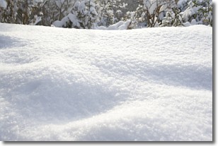
Snow is precipitation taking the form of ice crystals. Each ice crystal, or snowflake,
has unique characteristics, but all of them grow in a hexagonal structure.
Snowfall can last for sustained periods of time and result in significant buildup
of snow on the ground.
On the earth's surface, snow starts out light and powdery, but as it begins to melt
it tends to become more granular, producing small bits of ice which have the consistency of
sand. After several cycles of melting and freezing, snow can become very dense
and ice-like, commonly known as snow pack.
Next Topic: Stratocumulus Clouds
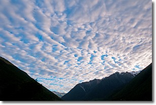
Weather Topic: What are Stratus Clouds?
Home - Education - Cloud Types - Stratus Clouds
 Next Topic: Wall Clouds
Stratus clouds are similar to altostratus clouds, but form at a
lower altitude and are identified by their fog-like appearance, lacking the
distinguishing features of most clouds.
Stratus clouds are wider than most clouds, and their base has a smooth, uniform
look which is lighter in color than a nimbostratus cloud.
The presence of a stratus cloud indicates the possibility of minor precipitation,
such as drizzle, but heavier precipitation does not typically arrive in the form
of a stratus cloud.
Next Topic: Wall Clouds
Current conditions powered by WeatherAPI.com


