Weather Alert in Alaska
Flood Watch issued August 25 at 8:05AM AKDT until August 26 at 4:00PM AKDT by NWS Fairbanks AK
AREAS AFFECTED: South Slopes Of The Central Brooks Range; South Slopes of the Western Brooks Range; Upper Kobuk Valleys
DESCRIPTION: * WHAT...Flooding caused by excessive rainfall continues to be possible. * WHERE...Including the following areas, South Slopes Of The Central Brooks Range, South Slopes of the Western Brooks Range and Upper Kobuk Valleys. This includes the cities of Wiseman, Coldfoot, Chandalar Dot Camp, Iniakuk Lake, The Dalton Highway From Mp 165 To Mp 232, Walker Lake, Ambler, Shungnak, And Kobuk. * WHEN...From 4 PM AKDT this afternoon through Tuesday afternoon. * IMPACTS...Excessive runoff may result in flooding of rivers, creeks, streams, and other low-lying and flood-prone locations. Creeks and streams may rise out of their banks. Low-water crossings may be flooded. * ADDITIONAL DETAILS... - Heavy rainfall is expected on Monday with light to moderate rainfall continuing through Tuesday. Rainfall amounts of 2 to 4 inches are forecast to be widespread across the watch area by Tuesday evening. Water levels are already high along the tributaries of the Koyukuk and Kobuk Rivers. The heavy rainfall is forecast to increase water levels to near or above flood stage by Monday night along smaller streams and rivers draining the south side of the Brooks Range. - Http://www.weather.gov/aprfc
INSTRUCTION: You should monitor later forecasts and be alert for possible Flood Warnings. Those living in areas prone to flooding should be prepared to take action should flooding develop. Stay tuned to further developments by listening to your local radio, television, or NOAA Weather Radio for further information.
Want more detail? Get the Complete 7 Day and Night Detailed Forecast!
Current U.S. National Radar--Current
The Current National Weather Radar is shown below with a UTC Time (subtract 5 hours from UTC to get Eastern Time).

National Weather Forecast--Current
The Current National Weather Forecast and National Weather Map are shown below.

National Weather Forecast for Tomorrow
Tomorrow National Weather Forecast and Tomorrow National Weather Map are show below.

North America Water Vapor (Moisture)
This map shows recent moisture content over North America. Bright and colored areas show high moisture (ie, clouds); brown indicates very little moisture present; black indicates no moisture.

Weather Topic: What is Sleet?
Home - Education - Precipitation - Sleet
 Next Topic: Snow
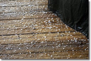
Sleet is a form of precipitation in which small ice pellets are the primary
components. These ice pellets are smaller and more translucent than hailstones,
and harder than graupel. Sleet is caused by specific atmospheric conditions and
therefore typically doesn't last for extended periods of time.
The condition which leads to sleet formation requires a warmer body of air to be
wedged in between two sub-freezing bodies of air. When snow falls through a warmer
layer of air it melts, and as it falls through the next sub-freezing body of air
it freezes again, forming ice pellets known as sleet. In some cases, water
droplets don't have time to freeze before reaching the surface and the result is
freezing rain.
Next Topic: Snow
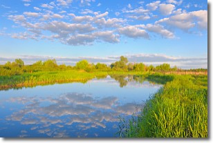
Weather Topic: What are Stratocumulus Clouds?
Home - Education - Cloud Types - Stratocumulus Clouds
 Next Topic: Stratus Clouds
Stratocumulus clouds are similar to altocumulus clouds in their
fluffy appearance, but have a slightly darker shade due to their additional mass.
A good way to distinguish the two cloud types is to hold your hand out and measure
the size of an individual cloud; if it is the size of your thumb it is generally
an altocumulus cloud, if it is the size of your hand it is generally a
stratocumulus cloud.
It is uncommon for stratocumulus clouds to produce precipitation, but if they do
it is usually a light rain or snow.
Next Topic: Stratus Clouds
Current conditions powered by WeatherAPI.com


