Weather Alert in Kansas
Flood Warning issued August 28 at 3:04AM CDT until August 31 at 2:05AM CDT by NWS Wichita KS
AREAS AFFECTED: Harvey, KS
DESCRIPTION: ...The Flood Warning continues for the following rivers in Kansas... Little Arkansas River At Alta Mills affecting Reno and Harvey Counties. Little Arkansas River Near Halstead affecting Harvey County. * WHAT...Minor flooding is forecast. * WHERE...Little Arkansas River near Halstead. * WHEN...From Friday afternoon to early Sunday morning. * IMPACTS...At 26.0 feet, Riverside Park floods north of the river. Flood waters may begin to encroach on K89 just north of the river bridge along with a trailer park and a few residences north of Halstead. Expect field flooding on both sides of Halstead Road north of the flood gates. More field flooding occurs north of Highway 50 on the east bank of the river. Just southeast of the city, SW 48th St becomes impassable from Hertzler Rd to Essex Heights. * ADDITIONAL DETAILS... - At 2:30 AM CDT Thursday the stage was 6.0 feet. - Forecast...The river is expected to rise above flood stage tomorrow afternoon to a crest of 25.6 feet early Saturday morning. It will then fall below flood stage early Saturday afternoon. - Flood stage is 25.0 feet.
INSTRUCTION: Do not drive into flooded areas or go around barricades. Nearly two feet of water will carry most vehicles away. Turn around, don't drown. Additional information is available at www.weather.gov. The next statement will be issued this afternoon at 315 PM CDT.
Want more detail? Get the Complete 7 Day and Night Detailed Forecast!
Current U.S. National Radar--Current
The Current National Weather Radar is shown below with a UTC Time (subtract 5 hours from UTC to get Eastern Time).

National Weather Forecast--Current
The Current National Weather Forecast and National Weather Map are shown below.

National Weather Forecast for Tomorrow
Tomorrow National Weather Forecast and Tomorrow National Weather Map are show below.

North America Water Vapor (Moisture)
This map shows recent moisture content over North America. Bright and colored areas show high moisture (ie, clouds); brown indicates very little moisture present; black indicates no moisture.

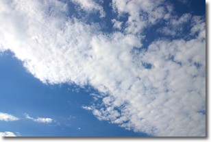
Weather Topic: What are Altocumulus Clouds?
Home - Education - Cloud Types - Altocumulus Clouds
 Next Topic: Altostratus Clouds
Similar to cirrocumulus clouds, altocumulus clouds are
characterized by cloud patches. They are distinguished by larger cloudlets
than cirrocumulus clouds but are still smaller than stratocumulus clouds.
Altocumulus clouds most commonly form in middle altitudes (between 2 and 5 km)
and may resemble, at times, the shape of a flying saucer.
These uncommon formations, called altocumulus lenticularis, are created by uplift
in the atmosphere and are most often seen in close proximity to mountains.
Next Topic: Altostratus Clouds
Weather Topic: What are Cirrocumulus Clouds?
Home - Education - Cloud Types - Cirrocumulus Clouds
 Next Topic: Cirrostratus Clouds
Cirrocumulus clouds form at high altitudes (usually around 5 km)
and have distinguishing characteristics displayed in a fine layer of
small cloud patches. These small cloud patches are sometimes referred to as
"cloudlets" in relation to the whole cloud formation.
Cirrocumulus clouds are formed from ice crystals and water droplets. Often, the
water droplets in the cloud freeze into ice crystals and the cloud becomes a
cirrostratus cloud. Because of this common occurrence, cirrocumulus cloud
formations generally pass rapidly.
Next Topic: Cirrostratus Clouds
Current conditions powered by WeatherAPI.com


