Weather Alert in North Carolina
Coastal Flood Warning issued August 21 at 9:50AM EDT until August 22 at 2:00PM EDT by NWS Wakefield VA
AREAS AFFECTED: Eastern Currituck; Virginia Beach
DESCRIPTION: * WHAT...For the Beach Hazards Statement, a high risk of rip currents is expected. For the High Surf Advisory, large breaking waves of 8 to 12 feet expected in the surf zone. For the Coastal Flood Warning, one to three feet of inundation above ground level possible in low-lying areas near shorelines and tidal waterways. * WHERE...In North Carolina, Eastern Currituck County. In Virginia, Virginia Beach. * WHEN...For the Coastal Flood Warning, until 2 PM EDT Friday. For the High Surf Advisory, until 7 AM EDT Friday. For the Beach Hazards Statement, through Friday evening. * IMPACTS...Numerous roads may be closed. Low lying property including homes, businesses, and some critical infrastructure may be inundated. Very dangerous swimming and surfing conditions are expected, as well as the wave action resulting in significant beach erosion. Rip currents can sweep even the best swimmers away from shore into deeper water. Dangerous shore break can throw a swimmer or surfer head first into the bottom causing neck and back injuries.
INSTRUCTION: Take the necessary actions to protect flood-prone property. If travel is required, do not drive around barricades or through water of unknown depth. Inexperienced swimmers should remain out of the water due to dangerous surf conditions. Remain out of the water to avoid hazardous swimming conditions.
Want more detail? Get the Complete 7 Day and Night Detailed Forecast!
Current U.S. National Radar--Current
The Current National Weather Radar is shown below with a UTC Time (subtract 5 hours from UTC to get Eastern Time).

National Weather Forecast--Current
The Current National Weather Forecast and National Weather Map are shown below.

National Weather Forecast for Tomorrow
Tomorrow National Weather Forecast and Tomorrow National Weather Map are show below.

North America Water Vapor (Moisture)
This map shows recent moisture content over North America. Bright and colored areas show high moisture (ie, clouds); brown indicates very little moisture present; black indicates no moisture.

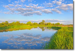
Weather Topic: What are Stratocumulus Clouds?
Home - Education - Cloud Types - Stratocumulus Clouds
 Next Topic: Stratus Clouds
Stratocumulus clouds are similar to altocumulus clouds in their
fluffy appearance, but have a slightly darker shade due to their additional mass.
A good way to distinguish the two cloud types is to hold your hand out and measure
the size of an individual cloud; if it is the size of your thumb it is generally
an altocumulus cloud, if it is the size of your hand it is generally a
stratocumulus cloud.
It is uncommon for stratocumulus clouds to produce precipitation, but if they do
it is usually a light rain or snow.
Next Topic: Stratus Clouds
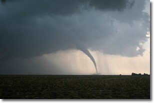
Weather Topic: What are Wall Clouds?
Home - Education - Cloud Types - Wall Clouds
 Next Topic: Altocumulus Clouds
A wall cloud forms underneath the base of a cumulonimbus cloud,
and can be a hotbed for deadly tornadoes.
Wall clouds are formed by air flowing into the cumulonimbus clouds, which can
result in the wall cloud descending from the base of the cumulonimbus cloud, or
rising fractus clouds which join to the base of the storm cloud as the wall cloud
takes shape.
Wall clouds can be very large, and in the Northern Hemisphere they generally
form at the southern edge of cumulonimbus clouds.
Next Topic: Altocumulus Clouds
Current conditions powered by WeatherAPI.com


