Weather Alert in Washington
Flood Warning issued March 20 at 7:58PM PDT until March 22 at 3:24AM PDT by NWS Seattle WA
AREAS AFFECTED: Snohomish, WA
DESCRIPTION: ...The Flood Warning is extended for the following rivers in Washington... Snohomish River Near Monroe affecting Snohomish County. * WHAT...Major flooding is occurring and major flooding is forecast. * WHERE...Snohomish River near Monroe. * WHEN...Until early Sunday morning. * IMPACTS...At 17.0 feet, the Snohomish River will cause major flooding...inundating farm land...roads...and some residential areas. Levees will likely suffer damage. Flooding will occur all along the river including headwaters...tributaries...and other streams within and near the Snohomish River Basin. A stage of 17 feet at this location corresponds to Phase 2 in the Snohomish County Flood Warning System. * ADDITIONAL DETAILS... - At 7:15 PM PDT Friday the stage was 17.7 feet. - Flood stage is 15.0 feet. - Recent Activity...The maximum river stage in the 24 hours ending at 7:15 PM PDT Friday was 17.7 feet. - Forecast...The river is expected to rise and to crest in major flood stage around 18.3 feet tonight. The river will then slowly recede and be below flood stage by Saturday evening. It will then further recede on Sunday. - Flood History...This crest compares to a previous crest of 18.0 feet on 02/16/1982. - http://www.weather.gov/safety/flood
INSTRUCTION: Motorists should not attempt to drive around barricades or drive cars through flooded areas. Turn around, don't drown when encountering flooded roads. Most flood deaths occur in vehicles. Be especially cautious at night when it is harder to recognize the dangers of flooding. Additional information is available at www.weather.gov. The next statement will be issued by late tonight at 400 AM PDT.
Want more detail? Get the Complete 7 Day and Night Detailed Forecast!
Current U.S. National Radar--Current
The Current National Weather Radar is shown below with a UTC Time (subtract 5 hours from UTC to get Eastern Time).

National Weather Forecast--Current
The Current National Weather Forecast and National Weather Map are shown below.

National Weather Forecast for Tomorrow
Tomorrow National Weather Forecast and Tomorrow National Weather Map are show below.

North America Water Vapor (Moisture)
This map shows recent moisture content over North America. Bright and colored areas show high moisture (ie, clouds); brown indicates very little moisture present; black indicates no moisture.

Weather Topic: What are Cirrocumulus Clouds?
Home - Education - Cloud Types - Cirrocumulus Clouds
 Next Topic: Cirrostratus Clouds
Cirrocumulus clouds form at high altitudes (usually around 5 km)
and have distinguishing characteristics displayed in a fine layer of
small cloud patches. These small cloud patches are sometimes referred to as
"cloudlets" in relation to the whole cloud formation.
Cirrocumulus clouds are formed from ice crystals and water droplets. Often, the
water droplets in the cloud freeze into ice crystals and the cloud becomes a
cirrostratus cloud. Because of this common occurrence, cirrocumulus cloud
formations generally pass rapidly.
Next Topic: Cirrostratus Clouds
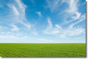
Weather Topic: What are Cirrus Clouds?
Home - Education - Cloud Types - Cirrus Clouds
 Next Topic: Condensation
Cirrus clouds are high-level clouds that occur above 20,000 feet
and are composed mainly of ice crystals.
They are thin and wispy in appearance.
What do they indicate?
They are often the first sign of an approaching storm.
Next Topic: Condensation
Current conditions powered by WeatherAPI.com


