Weather Alert in Kentucky
Special Weather Statement issued September 5 at 11:20PM EDT by NWS Jackson KY
AREAS AFFECTED: Jackson; Laurel; Floyd; Lee; Breathitt; Knott; Owsley; Perry; Clay; Leslie
DESCRIPTION: At 1120 PM EDT, Doppler radar was tracking strong thunderstorms along a line extending from Dumont to Sebastian to Fall Rock to Levi Jackson S.P.. Movement was east at 50 mph. HAZARD...Wind gusts up to 40 mph and pea size hail. SOURCE...Radar indicated. IMPACT...Gusty winds could knock down tree limbs and blow around unsecured objects. Minor hail damage to vegetation is possible. Locations impacted include... London, Hazard, Manchester, Hindman, Hyden, Booneville, Estill, Pippa Passes, Wayland, Buckhorn, Turin, Elic, Travellers Rest, Buck, Fariston, Handshoe, Southfork, Emmalena, Cowcreek, and Glo. THIS INCLUDES THE FOLLOWING HIGHWAYS... Hal Rogers Parkway between mile markers 1 and 59. Interstate 75 in east central Kentucky between mile markers 34 and 45. Kentucky Highway 80 in Floyd County between mile markers 1 and 5. Kentucky Highway 80 in Knott County between mile markers 1 and 20. Kentucky Highway 80 in Laurel County between mile markers 6 and 11. Kentucky Highway 80 in Perry County between mile markers 9 and 15.
INSTRUCTION: If outdoors, consider seeking shelter inside a building. Torrential rainfall is also occurring with these storms and may lead to localized flooding. Do not drive your vehicle through flooded roadways. Frequent cloud to ground lightning is occurring with these storms. Lightning can strike 10 miles away from a thunderstorm. Seek a safe shelter inside a building or vehicle. A Severe Thunderstorm Watch remains in effect until 100 AM EDT for south central and southeastern Kentucky.
Want more detail? Get the Complete 7 Day and Night Detailed Forecast!
Current U.S. National Radar--Current
The Current National Weather Radar is shown below with a UTC Time (subtract 5 hours from UTC to get Eastern Time).

National Weather Forecast--Current
The Current National Weather Forecast and National Weather Map are shown below.

National Weather Forecast for Tomorrow
Tomorrow National Weather Forecast and Tomorrow National Weather Map are show below.

North America Water Vapor (Moisture)
This map shows recent moisture content over North America. Bright and colored areas show high moisture (ie, clouds); brown indicates very little moisture present; black indicates no moisture.

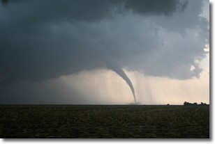
Weather Topic: What are Wall Clouds?
Home - Education - Cloud Types - Wall Clouds
 Next Topic: Altocumulus Clouds
A wall cloud forms underneath the base of a cumulonimbus cloud,
and can be a hotbed for deadly tornadoes.
Wall clouds are formed by air flowing into the cumulonimbus clouds, which can
result in the wall cloud descending from the base of the cumulonimbus cloud, or
rising fractus clouds which join to the base of the storm cloud as the wall cloud
takes shape.
Wall clouds can be very large, and in the Northern Hemisphere they generally
form at the southern edge of cumulonimbus clouds.
Next Topic: Altocumulus Clouds
Weather Topic: What are Altostratus Clouds?
Home - Education - Cloud Types - Altostratus Clouds
 Next Topic: Cirrocumulus Clouds
Altostratus clouds form at mid to high-level altitudes
(between 2 and 7 km) and are created by a warm, stable air mass which causes
water vapor
to condense as it rise through the atmosphere. Usually altostratus clouds are
featureless sheets characterized by a uniform color.
In some cases, wind punching through the cloud formation may give it a waved
appearance, called altostratus undulatus. Altostratus clouds
are commonly seen with other cloud formations accompanying them.
Next Topic: Cirrocumulus Clouds
Current conditions powered by WeatherAPI.com


