Weather Alert in Wyoming
Winter Weather Advisory issued February 9 at 1:18AM MST until February 9 at 5:00PM MST by NWS Riverton WY
AREAS AFFECTED: Yellowstone National Park
DESCRIPTION: * WHAT...Snow expected. Total snow accumulations of 6 to 11 inches south and east of the Lower Loop of Yellowstone National Park. Isolated higher amounts up to 16 inches are possible over the highest terrain. Total accumulations of 3 to 7 inches along the Upper Loop and northern portions of the Lower Loop. Accumulations of 1 to 3 inches near Mammoth. Gusty 20 to 35 mph winds are expected. * WHERE...Yellowstone National Park. * WHEN...Until 5 PM MST this afternoon. * IMPACTS...Travel could be difficult. * ADDITIONAL DETAILS...The period of heaviest snowfall is forecast to occur through 11 AM Monday with snow rates up to 1 inch per hour possible, especially over higher terrain.
INSTRUCTION: Slow down and use caution while traveling. For graphical depictions of the snowfall forecast, including the official NWS forecast, high end amounts, and low end amounts, visit https://weather.gov/riw/winter . For winter road conditions from the Wyoming Department of Transportation, visit https://wyoroad.info .
Want more detail? Get the Complete 7 Day and Night Detailed Forecast!
Current U.S. National Radar--Current
The Current National Weather Radar is shown below with a UTC Time (subtract 5 hours from UTC to get Eastern Time).

National Weather Forecast--Current
The Current National Weather Forecast and National Weather Map are shown below.

National Weather Forecast for Tomorrow
Tomorrow National Weather Forecast and Tomorrow National Weather Map are show below.

North America Water Vapor (Moisture)
This map shows recent moisture content over North America. Bright and colored areas show high moisture (ie, clouds); brown indicates very little moisture present; black indicates no moisture.

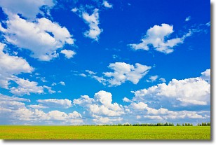
Weather Topic: What are Cumulus Clouds?
Home - Education - Cloud Types - Cumulus Clouds
 Next Topic: Drizzle
Cumulus clouds are fluffy and textured with rounded tops, and
may have flat bottoms. The border of a cumulus cloud
is clearly defined, and can have the appearance of cotton or cauliflower.
Cumulus clouds form at low altitudes (rarely above 2 km) but can grow very tall,
becoming cumulus congestus and possibly the even taller cumulonimbus clouds.
When cumulus clouds become taller, they have a greater chance of producing precipitation.
Next Topic: Drizzle
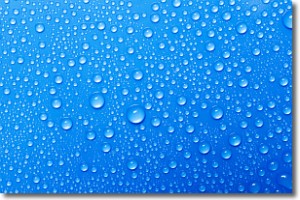
Weather Topic: What is Evaporation?
Home - Education - Precipitation - Evaporation
 Next Topic: Fog
Evaporation is the process which returns water from the earth
back to the atmosphere, and is another crucial process in the water cycle.
Evaporation is the transformation of liquid into gas, and it happens because
molecules are excited by the application of energy and turn into vapor.
In order for water to evaporate it has to be on the surface of a body of water.
Next Topic: Fog
Current conditions powered by WeatherAPI.com


