Weather Alert in Wyoming
Winter Weather Advisory issued February 9 at 1:18AM MST until February 9 at 5:00PM MST by NWS Riverton WY
AREAS AFFECTED: Absaroka Mountains
DESCRIPTION: * WHAT...Snow expected. Total snow accumulations of 6 to 11 inches. The highest elevations of the southwest Absaroka Mountains could see totals up to 15 inches. Wind gusts of 30 to 45 mph with occasional gusts as high as 50 mph. * WHERE...Absaroka Mountains. * WHEN...Until 5 PM MST this afternoon. * IMPACTS...Travel could be difficult. * ADDITIONAL DETAILS...Snow accumulations of 6 inches or greater will likely be confined to elevations above 8,500 FT ASL. Snow accumulations of 0.5 to 4 inches for elevations below 8,500 ft ASL. The period of heaviest snowfall is forecast to occur through 11 AM Monday with snow rates up to 1 inch per hour possible across higher terrain.
INSTRUCTION: Slow down and use caution while traveling. For graphical depictions of the snowfall forecast, including the official NWS forecast, high end amounts, and low end amounts, visit https://weather.gov/riw/winter . For winter road conditions from the Wyoming Department of Transportation, visit https://wyoroad.info .
Want more detail? Get the Complete 7 Day and Night Detailed Forecast!
Current U.S. National Radar--Current
The Current National Weather Radar is shown below with a UTC Time (subtract 5 hours from UTC to get Eastern Time).

National Weather Forecast--Current
The Current National Weather Forecast and National Weather Map are shown below.

National Weather Forecast for Tomorrow
Tomorrow National Weather Forecast and Tomorrow National Weather Map are show below.

North America Water Vapor (Moisture)
This map shows recent moisture content over North America. Bright and colored areas show high moisture (ie, clouds); brown indicates very little moisture present; black indicates no moisture.

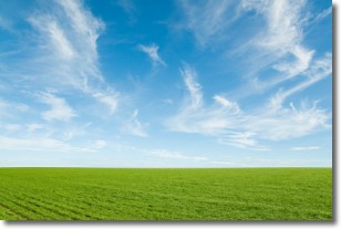
Weather Topic: What are Cirrus Clouds?
Home - Education - Cloud Types - Cirrus Clouds
 Next Topic: Condensation
Cirrus clouds are high-level clouds that occur above 20,000 feet
and are composed mainly of ice crystals.
They are thin and wispy in appearance.
What do they indicate?
They are often the first sign of an approaching storm.
Next Topic: Condensation
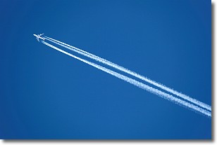
Weather Topic: What are Contrails?
Home - Education - Cloud Types - Contrails
 Next Topic: Cumulonimbus Clouds
A contrail is an artificial cloud, created by the passing of an
aircraft.
Contrails form because water vapor in the exhaust of aircraft engines is suspended
in the air under certain temperatures and humidity conditions. These contrails
are called exhaust contrails.
Another type of contrail can form due to a temporary reduction in air pressure
moving over the plane's surface, causing condensation.
These are called aerodynamic contrails.
When you can see your breath on a cold day, it is also because of condensation.
The reason contrails last longer than the condensation from your breath is
because the water in contrails freezes into ice particles.
Next Topic: Cumulonimbus Clouds
Current conditions powered by WeatherAPI.com


