Weather Alert in Nebraska
Red Flag Warning issued March 20 at 2:42PM CDT until March 22 at 4:00AM CDT by NWS North Platte NE
AREAS AFFECTED: Eastern Panhandle/Crescent Lake NWR; Sandhills/Valentine NWR/Nebraska National Forest; Niobrara Valley/Fort Niobrara NWR/Samuel R McKelvie National Forest; Loup Rivers Basin; Frenchman Basin; Loess Plains
DESCRIPTION: ...CRITICAL FIRE WEATHER CONDITIONS SATURDAY INTO THE OVERNIGHT SATURDAY NIGHT... .Record high temperatures Saturday in the 90s will lead to single digit relative humidity Saturday afternoon across the area. Low relative humidity will combine with gusty westerly winds to 35 MPH Saturday afternoon, producing critical fire weather conditions. An abrupt change in wind direction to the north will commence late Saturday evening across northern Nebraska, transitioning south into the overnight. Winds with this shift in wind direction will reach up to 45 MPH overnight. * AFFECTED AREA...Fire Weather Zone 204 Eastern Panhandle/Crescent Lake NWR, Fire Weather Zone 206 Sandhills/Valentine NWR/Nebraska National Forest, Fire Weather Zone 208 Niobrara Valley/Fort Niobrara NWR/Samuel R McKelvie National Forest, Fire Weather Zone 209 Loup Rivers Basin, Fire Weather Zone 210 Frenchman Basin and Fire Weather Zone 219 Loess Plains. * TIMING...Red Flag Warning in effect from 10 AM CDT (9 AM MDT) Saturday through 4 AM CDT (3 AM MDT) Sunday morning. * WINDS...West 15 to 25 mph with gusts up to 35 mph. * RELATIVE HUMIDITY...6 to 12. * TEMPERATURES...Up to 97. * LIGHTNING...None expected. * IMPACTS...Any fire starts will spread rapidly and will be difficult to control. * ADDITIONAL DETAILS...A sharp frontal boundary will arrive from the north late Saturday evening, producing an abrupt wind shift and gusts up to 45 mph during the late evening and overnight hours.
INSTRUCTION: A Red Flag Warning means that critical fire weather conditions are either occurring now, or will shortly. A combination of strong winds, low relative humidity, and warm temperatures can contribute to extreme fire behavior.
Want more detail? Get the Complete 7 Day and Night Detailed Forecast!
Current U.S. National Radar--Current
The Current National Weather Radar is shown below with a UTC Time (subtract 5 hours from UTC to get Eastern Time).

National Weather Forecast--Current
The Current National Weather Forecast and National Weather Map are shown below.

National Weather Forecast for Tomorrow
Tomorrow National Weather Forecast and Tomorrow National Weather Map are show below.

North America Water Vapor (Moisture)
This map shows recent moisture content over North America. Bright and colored areas show high moisture (ie, clouds); brown indicates very little moisture present; black indicates no moisture.

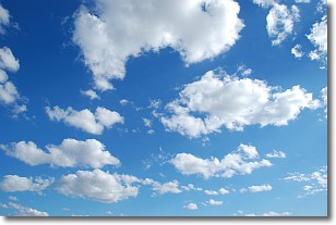
Weather Topic: What are Cumulonimbus Clouds?
Home - Education - Cloud Types - Cumulonimbus Clouds
 Next Topic: Cumulus Clouds
The final form taken by a growing cumulus cloud is the
cumulonimbus cloud, which is very tall and dense.
The tower of a cumulonimbus cloud can soar 23 km into the atmosphere, although
most commonly they stop growing at an altitude of 6 km.
Even small cumulonimbus clouds appear very large in comparison to other cloud types.
They can signal the approach of stormy weather, such as thunderstorms or blizzards.
Next Topic: Cumulus Clouds
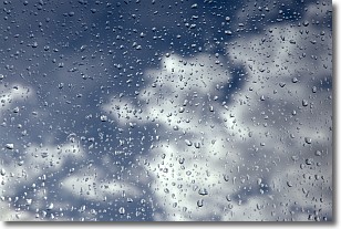
Weather Topic: What is Drizzle?
Home - Education - Precipitation - Drizzle
 Next Topic: Evaporation
Drizzle is precipitation in the form of water droplets which are
smaller than raindrops.
Drizzle is characterized by fine, gently falling droplets and typically does not
impact human habitation in a negative way. The exception to this is freezing drizzle,
a condition where drizzle freezes immediately upon reaching earth's surface.
Freezing drizzle is still less dangerous than freezing rain, but can
potentially result in hazardous road conditions.
Next Topic: Evaporation
Current conditions powered by WeatherAPI.com


