Weather Alert in Alabama
Fire Weather Watch issued March 26 at 1:47PM CDT until March 28 at 7:00PM CDT by NWS Huntsville AL
AREAS AFFECTED: Lauderdale; Colbert; Franklin; Lawrence; Limestone; Madison; Morgan; Marshall; Jackson; DeKalb; Winston; Cullman
DESCRIPTION: ...Fire Weather Watch in Effect Saturday 7 AM until 7 PM For All of North Alabama... The National Weather Service in Huntsville has issued a Fire Weather Watch for north Alabama, which is in effect from Saturday morning through Saturday evening. * AFFECTED AREA...Fire Weather Zone 001 Lauderdale, Fire Weather Zone 002 Colbert, Fire Weather Zone 003 Franklin AL, Fire Weather Zone 004 Lawrence, Fire Weather Zone 005 Limestone, Fire Weather Zone 006 Madison, Fire Weather Zone 007 Morgan, Fire Weather Zone 008 Marshall, Fire Weather Zone 009 Jackson, Fire Weather Zone 010 DeKalb, Fire Weather Zone 014 Winston and Fire Weather Zone 016 Cullman. * WINDS...Northeast 10 to 15 mph with gusts up to 30 mph. * RELATIVE HUMIDITY...As low as 23 percent. * IMPACTS...Any fires that develop will likely spread rapidly. Please obey any local burn bans that are in place!
INSTRUCTION: A Fire Weather Watch means that critical fire weather conditions are forecast to occur. Listen for later forecasts and possible Red Flag Warnings.
Want more detail? Get the Complete 7 Day and Night Detailed Forecast!
Current U.S. National Radar--Current
The Current National Weather Radar is shown below with a UTC Time (subtract 5 hours from UTC to get Eastern Time).

National Weather Forecast--Current
The Current National Weather Forecast and National Weather Map are shown below.

National Weather Forecast for Tomorrow
Tomorrow National Weather Forecast and Tomorrow National Weather Map are show below.

North America Water Vapor (Moisture)
This map shows recent moisture content over North America. Bright and colored areas show high moisture (ie, clouds); brown indicates very little moisture present; black indicates no moisture.

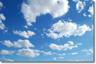
Weather Topic: What are Cumulonimbus Clouds?
Home - Education - Cloud Types - Cumulonimbus Clouds
 Next Topic: Cumulus Clouds
The final form taken by a growing cumulus cloud is the
cumulonimbus cloud, which is very tall and dense.
The tower of a cumulonimbus cloud can soar 23 km into the atmosphere, although
most commonly they stop growing at an altitude of 6 km.
Even small cumulonimbus clouds appear very large in comparison to other cloud types.
They can signal the approach of stormy weather, such as thunderstorms or blizzards.
Next Topic: Cumulus Clouds
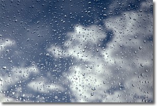
Weather Topic: What is Drizzle?
Home - Education - Precipitation - Drizzle
 Next Topic: Evaporation
Drizzle is precipitation in the form of water droplets which are
smaller than raindrops.
Drizzle is characterized by fine, gently falling droplets and typically does not
impact human habitation in a negative way. The exception to this is freezing drizzle,
a condition where drizzle freezes immediately upon reaching earth's surface.
Freezing drizzle is still less dangerous than freezing rain, but can
potentially result in hazardous road conditions.
Next Topic: Evaporation
Current conditions powered by WeatherAPI.com


