Weather Alert in Alabama
Fire Weather Watch issued March 26 at 1:47PM CDT until March 28 at 7:00PM CDT by NWS Huntsville AL
AREAS AFFECTED: Lauderdale; Colbert; Franklin; Lawrence; Limestone; Madison; Morgan; Marshall; Jackson; DeKalb; Winston; Cullman
DESCRIPTION: ...Fire Weather Watch in Effect Saturday 7 AM until 7 PM For All of North Alabama... The National Weather Service in Huntsville has issued a Fire Weather Watch for north Alabama, which is in effect from Saturday morning through Saturday evening. * AFFECTED AREA...Fire Weather Zone 001 Lauderdale, Fire Weather Zone 002 Colbert, Fire Weather Zone 003 Franklin AL, Fire Weather Zone 004 Lawrence, Fire Weather Zone 005 Limestone, Fire Weather Zone 006 Madison, Fire Weather Zone 007 Morgan, Fire Weather Zone 008 Marshall, Fire Weather Zone 009 Jackson, Fire Weather Zone 010 DeKalb, Fire Weather Zone 014 Winston and Fire Weather Zone 016 Cullman. * WINDS...Northeast 10 to 15 mph with gusts up to 30 mph. * RELATIVE HUMIDITY...As low as 23 percent. * IMPACTS...Any fires that develop will likely spread rapidly. Please obey any local burn bans that are in place!
INSTRUCTION: A Fire Weather Watch means that critical fire weather conditions are forecast to occur. Listen for later forecasts and possible Red Flag Warnings.
Want more detail? Get the Complete 7 Day and Night Detailed Forecast!
Current U.S. National Radar--Current
The Current National Weather Radar is shown below with a UTC Time (subtract 5 hours from UTC to get Eastern Time).

National Weather Forecast--Current
The Current National Weather Forecast and National Weather Map are shown below.

National Weather Forecast for Tomorrow
Tomorrow National Weather Forecast and Tomorrow National Weather Map are show below.

North America Water Vapor (Moisture)
This map shows recent moisture content over North America. Bright and colored areas show high moisture (ie, clouds); brown indicates very little moisture present; black indicates no moisture.

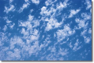
Weather Topic: What are Fractus Clouds?
Home - Education - Cloud Types - Fractus Clouds
 Next Topic: Freezing Rain
A fractus cloud (scud) is a fragmented, tattered cloud which has
likely been sheared off of another cloud. They are accessory clouds, meaning they
develop from parent clouds, and are named in a way which describes the original
cloud which contained them.
Fractus clouds which have originated from cumulus clouds are referred to as
cumulus fractus, while fractus clouds which have originated from stratus clouds
are referred to as stratus fractus. Under certain conditions a fractus cloud might
merge with another cloud, or develop into a cumulus cloud, but usually a
fractus cloud seen by itself will dissipate rapidly.
They are often observed on the leading and trailing edges of storm clouds,
and are a display of wind activity.
Next Topic: Freezing Rain
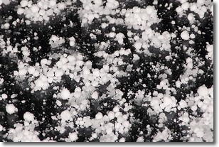
Weather Topic: What is Graupel?
Home - Education - Precipitation - Graupel
 Next Topic: Hail
Graupel is a form of precipitation that is created by atmospheric conditions
which cause supercooled water droplets to contact snow crystals and freeze to
their surface.
Sometimes known as soft hail or snow pellets, graupel is delicate and easily
destroyed by touch. Whereas hail usually falls during severe weather, graupel
doesn't require such conditions to form, and can form in mild precipitation
similar to situations which produce snowfall.
Next Topic: Hail
Current conditions powered by WeatherAPI.com


