Weather Alert in Ohio
Severe Thunderstorm Warning issued March 26 at 9:05PM EDT until March 26 at 9:45PM EDT by NWS Pittsburgh PA
AREAS AFFECTED: Coshocton, OH; Guernsey, OH; Muskingum, OH; Tuscarawas, OH
DESCRIPTION: SVRPBZ The National Weather Service in Pittsburgh has issued a * Severe Thunderstorm Warning for... Coshocton County in east central Ohio... Northwestern Guernsey County in east central Ohio... Northeastern Muskingum County in east central Ohio... Southwestern Tuscarawas County in east central Ohio... * Until 945 PM EDT. * At 905 PM EDT, a severe thunderstorm was located 25 miles northwest of Frazeysburg, or 30 miles northwest of Coshocton, moving east at 65 mph. HAZARD...60 mph wind gusts and half dollar size hail. SOURCE...Radar indicated. IMPACT...Hail damage to vehicles is expected. Expect wind damage to roofs, siding, and trees. * Locations impacted include... Coshocton, Newcomerstown, West Lafayette, Dresden, Warsaw, Port Washington, Conesville, Plainfield, Nellie, Otsego, Chili, Blissfield, Cooperdale, Layland, Boden, Bakersville, New Guilford and Walhonding.
INSTRUCTION: Seek shelter inside a well-built structure and stay away from windows. This storm is capable of producing damaging winds and large hail. Tornadoes can develop quickly from severe thunderstorms. Seek shelter immediately in an interior room on the lowest floor of a well-built structure. A Tornado Watch remains in effect until 1100 PM EDT Thursday for a portion of east central Ohio.
Want more detail? Get the Complete 7 Day and Night Detailed Forecast!
Current U.S. National Radar--Current
The Current National Weather Radar is shown below with a UTC Time (subtract 5 hours from UTC to get Eastern Time).

National Weather Forecast--Current
The Current National Weather Forecast and National Weather Map are shown below.

National Weather Forecast for Tomorrow
Tomorrow National Weather Forecast and Tomorrow National Weather Map are show below.

North America Water Vapor (Moisture)
This map shows recent moisture content over North America. Bright and colored areas show high moisture (ie, clouds); brown indicates very little moisture present; black indicates no moisture.

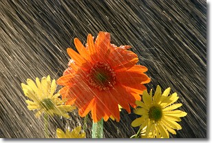
Weather Topic: What is Precipitation?
Home - Education - Precipitation - Precipitation
 Next Topic: Rain
Precipitation can refer to many different forms of water that
may fall from clouds. Precipitation occurs after a cloud has become saturated to
the point where its water particles are more dense than the air below the cloud.
In most cases, precipitation will reach the ground, but it is not uncommon for
precipitation to evaporate before it reaches the earth's surface.
When precipitation evaporates before it contacts the ground it is called Virga.
Graupel, hail, sleet, rain, drizzle, and snow are forms of precipitation, but fog
and mist are not considered precipitation because the water vapor which
constitutes them isn't dense enough to fall to the ground.
Next Topic: Rain
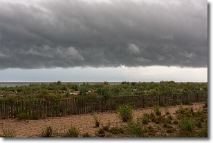
Weather Topic: What are Shelf Clouds?
Home - Education - Cloud Types - Shelf Clouds
 Next Topic: Sleet
A shelf cloud is similar to a wall cloud, but forms at the front
of a storm cloud, instead of at the rear, where wall clouds form.
A shelf cloud is caused by a series of events set into motion by the advancing
storm; first, cool air settles along the ground where precipitation has just fallen.
As the cool air is brought in, the warmer air is displaced, and rises above it,
because it is less dense. When the warmer air reaches the bottom of the storm cloud,
it begins to cool again, and the resulting condensation is a visible shelf cloud.
Next Topic: Sleet
Current conditions powered by WeatherAPI.com


