Weather Alert in Illinois
Flood Warning issued April 4 at 11:12AM EDT by NWS Indianapolis IN
AREAS AFFECTED: Crawford, IL; Lawrence, IL; Knox, IN; Sullivan, IN
DESCRIPTION: ...The Flood Warning continues for the following rivers in Illinois...Indiana... Wabash River at Terre Haute. Wabash River at Covington. Wabash River at Lafayette. Wabash River at Montezuma. Wabash River at Riverton. Wabash River at Hutsonville Legacy Power Plant Site. .Multiple rounds of rainfall have brought lowland flooding to the Wabash River basin. The Wabash is expected to crest at Lafayette on Sunday, but the crest is not expected to reach the lower Wabash until the weekend of April 11th. Forecast precipitation through 8 AM Monday morning is generally expected to be between 0.50 and 0.75 in the vicinity of the Wabash River. * WHAT...Minor flooding is forecast. * WHERE...Wabash River at Riverton. * WHEN...Until further notice. * IMPACTS...At 18.5 feet, High water surrounds elevated river cabins. County roads to these cabins are impassable. Agricultural flooding is in progress. Seep water develops behind levees. * ADDITIONAL DETAILS... - At 11:00 AM EDT Saturday /10:00 AM CDT Saturday/ the stage was 15.0 feet. - Forecast...The river is expected to rise above flood stage late this morning and continue rising to a crest of 19.0 feet early Friday morning. - Flood stage is 15.0 feet. - http://www.weather.gov/safety/flood
INSTRUCTION: Turn around, don't drown when encountering flooded roads. Most flood deaths occur in vehicles. Caution is urged when walking near riverbanks. Additional information is available at www.weather.gov/ind. The next statement should be issued late tonight by around 215 AM EDT /115 AM CDT/.
Want more detail? Get the Complete 7 Day and Night Detailed Forecast!
Current U.S. National Radar--Current
The Current National Weather Radar is shown below with a UTC Time (subtract 5 hours from UTC to get Eastern Time).

National Weather Forecast--Current
The Current National Weather Forecast and National Weather Map are shown below.

National Weather Forecast for Tomorrow
Tomorrow National Weather Forecast and Tomorrow National Weather Map are show below.

North America Water Vapor (Moisture)
This map shows recent moisture content over North America. Bright and colored areas show high moisture (ie, clouds); brown indicates very little moisture present; black indicates no moisture.

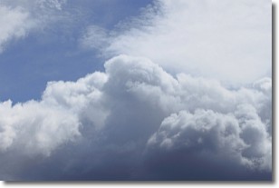
Weather Topic: What are Nimbostratus Clouds?
Home - Education - Cloud Types - Nimbostratus Clouds
 Next Topic: Precipitation
A nimbostratus cloud is similar to a stratus cloud in its formless,
smooth appearance. However, a nimbostratus cloud is darker than a stratus cloud,
because it is thicker.
Unlike a stratus cloud, a nimbostratus cloud typically brings with it the threat
of moderate to heavy precipitation. In some cases, the precipitation may evaporate
before reaching the ground, a phenomenon known as virga.
Next Topic: Precipitation
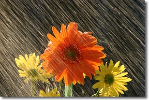
Weather Topic: What is Rain?
Home - Education - Precipitation - Rain
 Next Topic: Shelf Clouds
Precipitation in the form of water droplets is called rain.
Rain generally has a tendency to fall with less intensity over a greater period
of time, and when rainfall is more severe it is usually less sustained.
Rain is the most common form of precipitation and happens with greater frequency
depending on the season and regional influences. Cities have been shown to have
an observable effect on rainfall, due to an effect called the urban heat island.
Compared to upwind, monthly rainfall between twenty and forty miles downwind of
cities is 30% greater.
Next Topic: Shelf Clouds
Current conditions powered by WeatherAPI.com


