Weather Alert in Washington
Hydrologic Outlook issued March 20 at 4:38PM PDT by NWS Pendleton OR
AREAS AFFECTED: Kittitas Valley; Yakima Valley; Lower Columbia Basin of Washington; Simcoe Highlands; Upper Slopes of the Eastern Washington Cascades Crest; Lower Slopes of the Eastern Washington Cascades Crest
DESCRIPTION: ESFPDT Moderate rain is expected to continue along the Washington Cascade crest through tonight before ending Saturday morning. Temperatures are cooling but will remain above freezing during the day, Snowmelt is expected to continue but at decreasing levels. The rain and snow melt will keep water levels high in rivers and streams flowing off the Cascades. The Naches River at Naches and the Yakima River at Easton, Umtanum, Parker and Kiona are expected to remain at or rise above minor flood stage through Sunday evening and Flood Warnings have been issued for those locations. The Naches River at Cliffdell and several locations on the Yakima River are either above action stage or are expected to reach action stage at times through this weekend. Other streams and rivers will continue to have elevated water levels. Please monitor the latest river forecasts from the National Weather Service for additional information.
INSTRUCTION: N/A
Want more detail? Get the Complete 7 Day and Night Detailed Forecast!
Current U.S. National Radar--Current
The Current National Weather Radar is shown below with a UTC Time (subtract 5 hours from UTC to get Eastern Time).

National Weather Forecast--Current
The Current National Weather Forecast and National Weather Map are shown below.

National Weather Forecast for Tomorrow
Tomorrow National Weather Forecast and Tomorrow National Weather Map are show below.

North America Water Vapor (Moisture)
This map shows recent moisture content over North America. Bright and colored areas show high moisture (ie, clouds); brown indicates very little moisture present; black indicates no moisture.

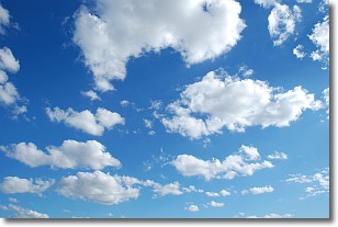
Weather Topic: What are Cumulonimbus Clouds?
Home - Education - Cloud Types - Cumulonimbus Clouds
 Next Topic: Cumulus Clouds
The final form taken by a growing cumulus cloud is the
cumulonimbus cloud, which is very tall and dense.
The tower of a cumulonimbus cloud can soar 23 km into the atmosphere, although
most commonly they stop growing at an altitude of 6 km.
Even small cumulonimbus clouds appear very large in comparison to other cloud types.
They can signal the approach of stormy weather, such as thunderstorms or blizzards.
Next Topic: Cumulus Clouds
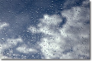
Weather Topic: What is Drizzle?
Home - Education - Precipitation - Drizzle
 Next Topic: Evaporation
Drizzle is precipitation in the form of water droplets which are
smaller than raindrops.
Drizzle is characterized by fine, gently falling droplets and typically does not
impact human habitation in a negative way. The exception to this is freezing drizzle,
a condition where drizzle freezes immediately upon reaching earth's surface.
Freezing drizzle is still less dangerous than freezing rain, but can
potentially result in hazardous road conditions.
Next Topic: Evaporation
Current conditions powered by WeatherAPI.com


