Weather Alert in Hawaii
Flood Watch issued February 7 at 3:41PM HST until February 9 at 6:00PM HST by NWS Honolulu HI
AREAS AFFECTED: Niihau; Kauai Southwest; Kauai Mountains; Waianae Coast; Oahu North Shore; Olomana; Central Oahu; Waianae Mountains; Lanai Mauka; Kahoolawe; Maui Windward West; Maui Leeward West; Haleakala Summit; Kona; Kohala; Big Island Interior; Kauai North; Kauai East; Kauai South; East Honolulu; Honolulu Metro; Ewa Plain; Koolau Windward; Koolau Leeward; Molokai Windward; Molokai Southeast; Molokai North; Molokai West; Molokai Leeward South; Lanai Windward; Lanai Leeward; Lanai South; Maui Central Valley North; Maui Central Valley South; Windward Haleakala; Kipahulu; South Maui/Upcountry; South Haleakala; Big Island South; Big Island Southeast; Big Island East; Big Island North
DESCRIPTION: ...FLOOD WATCH IN EFFECT FOR ALL HAWAIIAN ISLANDS THROUGH MONDAY AFTERNOON... * WHAT...Flash flooding caused by excessive rainfall continues to be possible. * WHERE...All the main Hawaiian islands. * WHEN...Through Monday afternoon. * IMPACTS...Flood prone roads and other low lying areas may be closed due to elevated runoff and overflowing streams. Urban areas may receive more significant flooding and property damage due to rapid runoff. * ADDITIONAL DETAILS... - A front will stall near Maui County through the weekend, allowing deep tropical moisture to pool over the island chain. This in combination with a disturbance aloft moving over the state, will bring the potential for heavy rainfall, a few thunderstorms and flash flooding beginning this afternoon and continuing through Monday afternoon. The greatest risk for flash flooding is expected in windward areas.
INSTRUCTION: You should monitor later forecasts and be prepared to take action should Flash Flood Warnings be issued.
Want more detail? Get the Complete 7 Day and Night Detailed Forecast!
Current U.S. National Radar--Current
The Current National Weather Radar is shown below with a UTC Time (subtract 5 hours from UTC to get Eastern Time).

National Weather Forecast--Current
The Current National Weather Forecast and National Weather Map are shown below.

National Weather Forecast for Tomorrow
Tomorrow National Weather Forecast and Tomorrow National Weather Map are show below.

North America Water Vapor (Moisture)
This map shows recent moisture content over North America. Bright and colored areas show high moisture (ie, clouds); brown indicates very little moisture present; black indicates no moisture.

Weather Topic: What is Drizzle?
Home - Education - Precipitation - Drizzle
 Next Topic: Evaporation
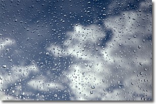
Drizzle is precipitation in the form of water droplets which are
smaller than raindrops.
Drizzle is characterized by fine, gently falling droplets and typically does not
impact human habitation in a negative way. The exception to this is freezing drizzle,
a condition where drizzle freezes immediately upon reaching earth's surface.
Freezing drizzle is still less dangerous than freezing rain, but can
potentially result in hazardous road conditions.
Next Topic: Evaporation
Weather Topic: What is Fog?
Home - Education - Cloud Types - Fog
 Next Topic: Fractus Clouds
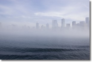
Fog is technically a type of stratus cloud, which lies along the
ground and obscures visibility.
It is usually created when humidity in the air condenses into tiny water droplets.
Because of this, some places are more prone to foggy weather, such as regions
close to a body of water.
Fog is similar to mist; both are the appearance of water droplets suspended in
the air, but fog is the term applied to the condition when visibility is less than 1 km.
Next Topic: Fractus Clouds
Current conditions powered by WeatherAPI.com


