Weather Alert in Kentucky
Special Weather Statement issued February 7 at 9:39PM EST by NWS Louisville KY
AREAS AFFECTED: Scott; Harrison; Fayette; Bourbon; Nicholas; Clark
DESCRIPTION: The latest forecasts suggest that a narrow band of light snow will impact portions of the Bluegrass region of central Kentucky Sunday morning. The time of light snow appears to favor the 600 am to Noon EST timeframe. Snowfall accumulations of a coating to around a half inch will be possible. Again, this band will be quite narrow and areas outside this swath will likely see little to no snow. The exact placement of this snowband remains uncertain. Currently, the highest probabilities of an inch of snow are across northeast portions of the Bluegrass region including the counties of Scott, Harrison, Bourbon, Fayette, Clark, and Nicholas. Those with travel plans Sunday morning are encouraged to monitor the latest forecasts. Be prepared for rapidly changing visibilitiesand potentially slick driving conditions.
INSTRUCTION: N/A
Want more detail? Get the Complete 7 Day and Night Detailed Forecast!
Current U.S. National Radar--Current
The Current National Weather Radar is shown below with a UTC Time (subtract 5 hours from UTC to get Eastern Time).

National Weather Forecast--Current
The Current National Weather Forecast and National Weather Map are shown below.

National Weather Forecast for Tomorrow
Tomorrow National Weather Forecast and Tomorrow National Weather Map are show below.

North America Water Vapor (Moisture)
This map shows recent moisture content over North America. Bright and colored areas show high moisture (ie, clouds); brown indicates very little moisture present; black indicates no moisture.

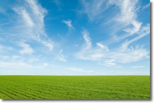
Weather Topic: What are Cirrus Clouds?
Home - Education - Cloud Types - Cirrus Clouds
 Next Topic: Condensation
Cirrus clouds are high-level clouds that occur above 20,000 feet
and are composed mainly of ice crystals.
They are thin and wispy in appearance.
What do they indicate?
They are often the first sign of an approaching storm.
Next Topic: Condensation
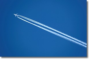
Weather Topic: What are Contrails?
Home - Education - Cloud Types - Contrails
 Next Topic: Cumulonimbus Clouds
A contrail is an artificial cloud, created by the passing of an
aircraft.
Contrails form because water vapor in the exhaust of aircraft engines is suspended
in the air under certain temperatures and humidity conditions. These contrails
are called exhaust contrails.
Another type of contrail can form due to a temporary reduction in air pressure
moving over the plane's surface, causing condensation.
These are called aerodynamic contrails.
When you can see your breath on a cold day, it is also because of condensation.
The reason contrails last longer than the condensation from your breath is
because the water in contrails freezes into ice particles.
Next Topic: Cumulonimbus Clouds
Current conditions powered by WeatherAPI.com


