Weather Alert in Oregon
Special Weather Statement
Special Weather Statement issued August 21 at 1:57PM PDT by NWS Portland OR
AREAS AFFECTED: East Portland Metro; West Columbia River Gorge of Oregon above 500 ft; West Columbia River Gorge I-84 Corridor; Central Columbia River Gorge I-84 Corridor; East Clark County Lowlands; West Columbia River Gorge - SR 14; Central Columbia River Gorge - SR 14; South Washington Cascades
DESCRIPTION: Breezy easterly winds will develop Friday morning and continue through Friday evening for the eastern Portland/Vancouver metro, and through Friday night for the Columbia River Gorge and adjacent Cascade ridgetops. Winds will be strongest on exposed ridgetops where wind gusts will most likely peak between 25-35 mph. Elsewhere, expect wind gusts between 15-20 mph, except up to 30 mph in the western Columbia River Gorge. The breezy east winds will occur simultaneously with low relative humidity values of 20-30% or less, resulting in near critical fire weather conditions. Use extra caution with potential ignition sources, especially in grassy areas. Outdoor burning is not recommended.
INSTRUCTION: N/A
Want more detail? Get the Complete 7 Day and Night Detailed Forecast!
Current U.S. National Radar--Current
The Current National Weather Radar is shown below with a UTC Time (subtract 5 hours from UTC to get Eastern Time).

National Weather Forecast--Current
The Current National Weather Forecast and National Weather Map are shown below.

National Weather Forecast for Tomorrow
Tomorrow National Weather Forecast and Tomorrow National Weather Map are show below.

North America Water Vapor (Moisture)
This map shows recent moisture content over North America. Bright and colored areas show high moisture (ie, clouds); brown indicates very little moisture present; black indicates no moisture.

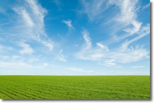
Weather Topic: What are Cirrus Clouds?
Home - Education - Cloud Types - Cirrus Clouds
 Next Topic: Condensation
Cirrus clouds are high-level clouds that occur above 20,000 feet
and are composed mainly of ice crystals.
They are thin and wispy in appearance.
What do they indicate?
They are often the first sign of an approaching storm.
Next Topic: Condensation
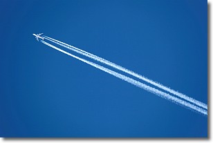
Weather Topic: What are Contrails?
Home - Education - Cloud Types - Contrails
 Next Topic: Cumulonimbus Clouds
A contrail is an artificial cloud, created by the passing of an
aircraft.
Contrails form because water vapor in the exhaust of aircraft engines is suspended
in the air under certain temperatures and humidity conditions. These contrails
are called exhaust contrails.
Another type of contrail can form due to a temporary reduction in air pressure
moving over the plane's surface, causing condensation.
These are called aerodynamic contrails.
When you can see your breath on a cold day, it is also because of condensation.
The reason contrails last longer than the condensation from your breath is
because the water in contrails freezes into ice particles.
Next Topic: Cumulonimbus Clouds
Current conditions powered by WeatherAPI.com


