Weather Alert in North Carolina
High Surf Advisory issued August 22 at 10:56AM EDT until August 23 at 12:00AM EDT by NWS Newport/Morehead City NC
AREAS AFFECTED: Northern Outer Banks
DESCRIPTION: * WHAT...For the Coastal Flood Advisory, up to one to two feet of inundation above ground level near the beachfront. For the Beach Hazards Statement, dangerous rip currents. For the High Surf Advisory, large breaking waves of 6 to 10 feet in the surf zone. * WHERE...Northern Outer Banks north of Oregon Inlet. * WHEN...For the Coastal Flood Advisory, until midnight EDT tonight. For the Beach Hazards Statement, through this evening. For the High Surf Advisory, until midnight EDT tonight. * IMPACTS...Up to 1 to 2 feet of inundation above ground level is possible in low-lying areas near the beach front resulting in a low threat of property damage. Some low lying property including parking lots, parks, lawns, and homes adjacent to the waterfront may experience shallow flooding. Dangerous swimming and surfing conditions and localized beach erosion. Rip currents can sweep even the best swimmers away from shore into deeper water.
INSTRUCTION: Do not drive around barricades or through water of unknown depth. Take the necessary actions to protect flood-prone property. Life-threatening rip currents. If caught in a rip current, remain calm. Swim in a direction following the shoreline. If tired, float or tread water until out of the rip current. If unable to escape, face the shore and call or wave for help. Shore break occurs when waves break directly on the beach. It is extremely important to protect your head and neck whenever you are in breaking waves by keeping your hands in front of you at all times.
Want more detail? Get the Complete 7 Day and Night Detailed Forecast!
Current U.S. National Radar--Current
The Current National Weather Radar is shown below with a UTC Time (subtract 5 hours from UTC to get Eastern Time).

National Weather Forecast--Current
The Current National Weather Forecast and National Weather Map are shown below.

National Weather Forecast for Tomorrow
Tomorrow National Weather Forecast and Tomorrow National Weather Map are show below.

North America Water Vapor (Moisture)
This map shows recent moisture content over North America. Bright and colored areas show high moisture (ie, clouds); brown indicates very little moisture present; black indicates no moisture.

Weather Topic: What is Sleet?
Home - Education - Precipitation - Sleet
 Next Topic: Snow
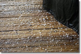
Sleet is a form of precipitation in which small ice pellets are the primary
components. These ice pellets are smaller and more translucent than hailstones,
and harder than graupel. Sleet is caused by specific atmospheric conditions and
therefore typically doesn't last for extended periods of time.
The condition which leads to sleet formation requires a warmer body of air to be
wedged in between two sub-freezing bodies of air. When snow falls through a warmer
layer of air it melts, and as it falls through the next sub-freezing body of air
it freezes again, forming ice pellets known as sleet. In some cases, water
droplets don't have time to freeze before reaching the surface and the result is
freezing rain.
Next Topic: Snow
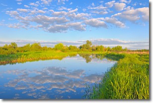
Weather Topic: What are Stratocumulus Clouds?
Home - Education - Cloud Types - Stratocumulus Clouds
 Next Topic: Stratus Clouds
Stratocumulus clouds are similar to altocumulus clouds in their
fluffy appearance, but have a slightly darker shade due to their additional mass.
A good way to distinguish the two cloud types is to hold your hand out and measure
the size of an individual cloud; if it is the size of your thumb it is generally
an altocumulus cloud, if it is the size of your hand it is generally a
stratocumulus cloud.
It is uncommon for stratocumulus clouds to produce precipitation, but if they do
it is usually a light rain or snow.
Next Topic: Stratus Clouds
Current conditions powered by WeatherAPI.com


