Weather Alert in Florida
Coastal Flood Statement issued August 20 at 11:35AM EDT until August 21 at 5:00AM EDT by NWS Key West FL
AREAS AFFECTED: Monroe Upper Keys; Monroe Middle Keys
DESCRIPTION: * WHAT...Minor saltwater flooding. * WHERE...Upper and Middle Florida Keys. * WHEN...Through late tonight. * IMPACTS...Minor saltwater flooding of low elevation streets and lots is likely. Some storm drains will overflow, and some seawalls and docks will be overtopped. Boaters can expect less clearance under fixed bridges. Motorists should remember that persistent puddles around the times of high tide are almost certain to contain a mix of saltwater.
INSTRUCTION: Do not drive through flooded roadways.
Want more detail? Get the Complete 7 Day and Night Detailed Forecast!
Current U.S. National Radar--Current
The Current National Weather Radar is shown below with a UTC Time (subtract 5 hours from UTC to get Eastern Time).

National Weather Forecast--Current
The Current National Weather Forecast and National Weather Map are shown below.

National Weather Forecast for Tomorrow
Tomorrow National Weather Forecast and Tomorrow National Weather Map are show below.

North America Water Vapor (Moisture)
This map shows recent moisture content over North America. Bright and colored areas show high moisture (ie, clouds); brown indicates very little moisture present; black indicates no moisture.

Weather Topic: What is Drizzle?
Home - Education - Precipitation - Drizzle
 Next Topic: Evaporation
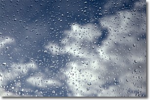
Drizzle is precipitation in the form of water droplets which are
smaller than raindrops.
Drizzle is characterized by fine, gently falling droplets and typically does not
impact human habitation in a negative way. The exception to this is freezing drizzle,
a condition where drizzle freezes immediately upon reaching earth's surface.
Freezing drizzle is still less dangerous than freezing rain, but can
potentially result in hazardous road conditions.
Next Topic: Evaporation
Weather Topic: What is Fog?
Home - Education - Cloud Types - Fog
 Next Topic: Fractus Clouds
Fog is technically a type of stratus cloud, which lies along the
ground and obscures visibility.
It is usually created when humidity in the air condenses into tiny water droplets.
Because of this, some places are more prone to foggy weather, such as regions
close to a body of water.
Fog is similar to mist; both are the appearance of water droplets suspended in
the air, but fog is the term applied to the condition when visibility is less than 1 km.
Next Topic: Fractus Clouds
Current conditions powered by WeatherAPI.com


