Weather Alert in New York
Winter Weather Advisory issued February 9 at 12:55PM EST until February 11 at 7:00AM EST by NWS Burlington VT
AREAS AFFECTED: Eastern Clinton; Grand Isle; Western Franklin; Western Chittenden; Lamoille; Eastern Franklin; Eastern Chittenden; Eastern Addison; Eastern Rutland
DESCRIPTION: * WHAT...Snow expected. Total snow accumulations between 3 and 6 inches. * WHERE...The northern Champlain Valley and portions of the central and northern Green Mountains. * WHEN...From 2 PM Tuesday to 7 AM EST Wednesday. * IMPACTS...The heaviest snowfall rates are expected to occur during the Tuesday evening commute and will likely increase impacts during this time. Roads, and especially bridges and overpasses, will likely become slick and hazardous. Plan on slippery road conditions. The hazardous conditions could also impact the Wednesday morning commute. * ADDITIONAL DETAILS...The heaviest snow will occur between 5 PM and 9 PM. Snowfall rates could exceed 1 to 1.5 inch per hour rates at times.
INSTRUCTION: Slow down and use caution while traveling. For the latest on road conditions in Vermont, visit https://newengland511.org and for New York, visit https://511ny.org.
Want more detail? Get the Complete 7 Day and Night Detailed Forecast!
Current U.S. National Radar--Current
The Current National Weather Radar is shown below with a UTC Time (subtract 5 hours from UTC to get Eastern Time).

National Weather Forecast--Current
The Current National Weather Forecast and National Weather Map are shown below.

National Weather Forecast for Tomorrow
Tomorrow National Weather Forecast and Tomorrow National Weather Map are show below.

North America Water Vapor (Moisture)
This map shows recent moisture content over North America. Bright and colored areas show high moisture (ie, clouds); brown indicates very little moisture present; black indicates no moisture.

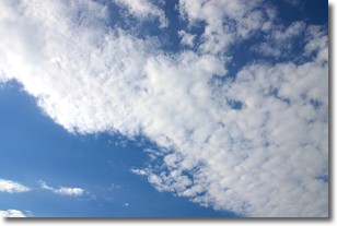
Weather Topic: What are Altocumulus Clouds?
Home - Education - Cloud Types - Altocumulus Clouds
 Next Topic: Altostratus Clouds
Similar to cirrocumulus clouds, altocumulus clouds are
characterized by cloud patches. They are distinguished by larger cloudlets
than cirrocumulus clouds but are still smaller than stratocumulus clouds.
Altocumulus clouds most commonly form in middle altitudes (between 2 and 5 km)
and may resemble, at times, the shape of a flying saucer.
These uncommon formations, called altocumulus lenticularis, are created by uplift
in the atmosphere and are most often seen in close proximity to mountains.
Next Topic: Altostratus Clouds
Weather Topic: What are Cirrocumulus Clouds?
Home - Education - Cloud Types - Cirrocumulus Clouds
 Next Topic: Cirrostratus Clouds
Cirrocumulus clouds form at high altitudes (usually around 5 km)
and have distinguishing characteristics displayed in a fine layer of
small cloud patches. These small cloud patches are sometimes referred to as
"cloudlets" in relation to the whole cloud formation.
Cirrocumulus clouds are formed from ice crystals and water droplets. Often, the
water droplets in the cloud freeze into ice crystals and the cloud becomes a
cirrostratus cloud. Because of this common occurrence, cirrocumulus cloud
formations generally pass rapidly.
Next Topic: Cirrostratus Clouds
Current conditions powered by WeatherAPI.com


