Weather Alert in New York
Winter Weather Advisory issued February 9 at 12:55PM EST until February 11 at 7:00AM EST by NWS Burlington VT
AREAS AFFECTED: Northern St. Lawrence; Northern Franklin; Southeastern St. Lawrence; Southern Franklin; Western Clinton; Western Essex; Southwestern St. Lawrence
DESCRIPTION: * WHAT...Snow expected. Total snow accumulations between 3 and 6 inches. * WHERE...The St. Lawrence Valley and the northern Adirondacks. * WHEN...From 10 AM Tuesday to 7 AM EST Wednesday. * IMPACTS...The heaviest snowfall rates are expected to occur during the Tuesday evening commute and will likely increase impacts during this time. Roads, and especially bridges and overpasses, will likely become slick and hazardous. Plan on slippery road conditions. The hazardous conditions could also impact the Wednesday morning commute. * ADDITIONAL DETAILS...The heaviest snow will occur between 2 PM and 6 PM. Snowfall rates could exceed 1 to 1.5 inch per hour rates at times.
INSTRUCTION: Slow down and use caution while traveling. For the latest on road conditions in New York, visit https://511ny.org.
Want more detail? Get the Complete 7 Day and Night Detailed Forecast!
Current U.S. National Radar--Current
The Current National Weather Radar is shown below with a UTC Time (subtract 5 hours from UTC to get Eastern Time).

National Weather Forecast--Current
The Current National Weather Forecast and National Weather Map are shown below.

National Weather Forecast for Tomorrow
Tomorrow National Weather Forecast and Tomorrow National Weather Map are show below.

North America Water Vapor (Moisture)
This map shows recent moisture content over North America. Bright and colored areas show high moisture (ie, clouds); brown indicates very little moisture present; black indicates no moisture.

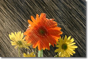
Weather Topic: What is Precipitation?
Home - Education - Precipitation - Precipitation
 Next Topic: Rain
Precipitation can refer to many different forms of water that
may fall from clouds. Precipitation occurs after a cloud has become saturated to
the point where its water particles are more dense than the air below the cloud.
In most cases, precipitation will reach the ground, but it is not uncommon for
precipitation to evaporate before it reaches the earth's surface.
When precipitation evaporates before it contacts the ground it is called Virga.
Graupel, hail, sleet, rain, drizzle, and snow are forms of precipitation, but fog
and mist are not considered precipitation because the water vapor which
constitutes them isn't dense enough to fall to the ground.
Next Topic: Rain
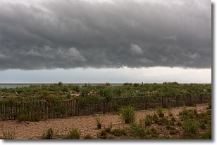
Weather Topic: What are Shelf Clouds?
Home - Education - Cloud Types - Shelf Clouds
 Next Topic: Sleet
A shelf cloud is similar to a wall cloud, but forms at the front
of a storm cloud, instead of at the rear, where wall clouds form.
A shelf cloud is caused by a series of events set into motion by the advancing
storm; first, cool air settles along the ground where precipitation has just fallen.
As the cool air is brought in, the warmer air is displaced, and rises above it,
because it is less dense. When the warmer air reaches the bottom of the storm cloud,
it begins to cool again, and the resulting condensation is a visible shelf cloud.
Next Topic: Sleet
Current conditions powered by WeatherAPI.com


